We have been discussing the proposal for a rapid transit Circle Line to make connections with (and cross) all existing bus and rail routes in the city.
So far, under this title, we have discussed the renovation and reopening of the Paulina Connector so that the Douglas Line (Blue Line) can connect with the Lake Street (Green) Line again. (See this link.) We have also discussed the section of the Circle that would be a new line connecting the Douglas Line with the Midway Line (Orange). (See this link.) We haven't gotten to the third part of the original proposal for the Circle Line. (Will they call it the Rainbow Line?)
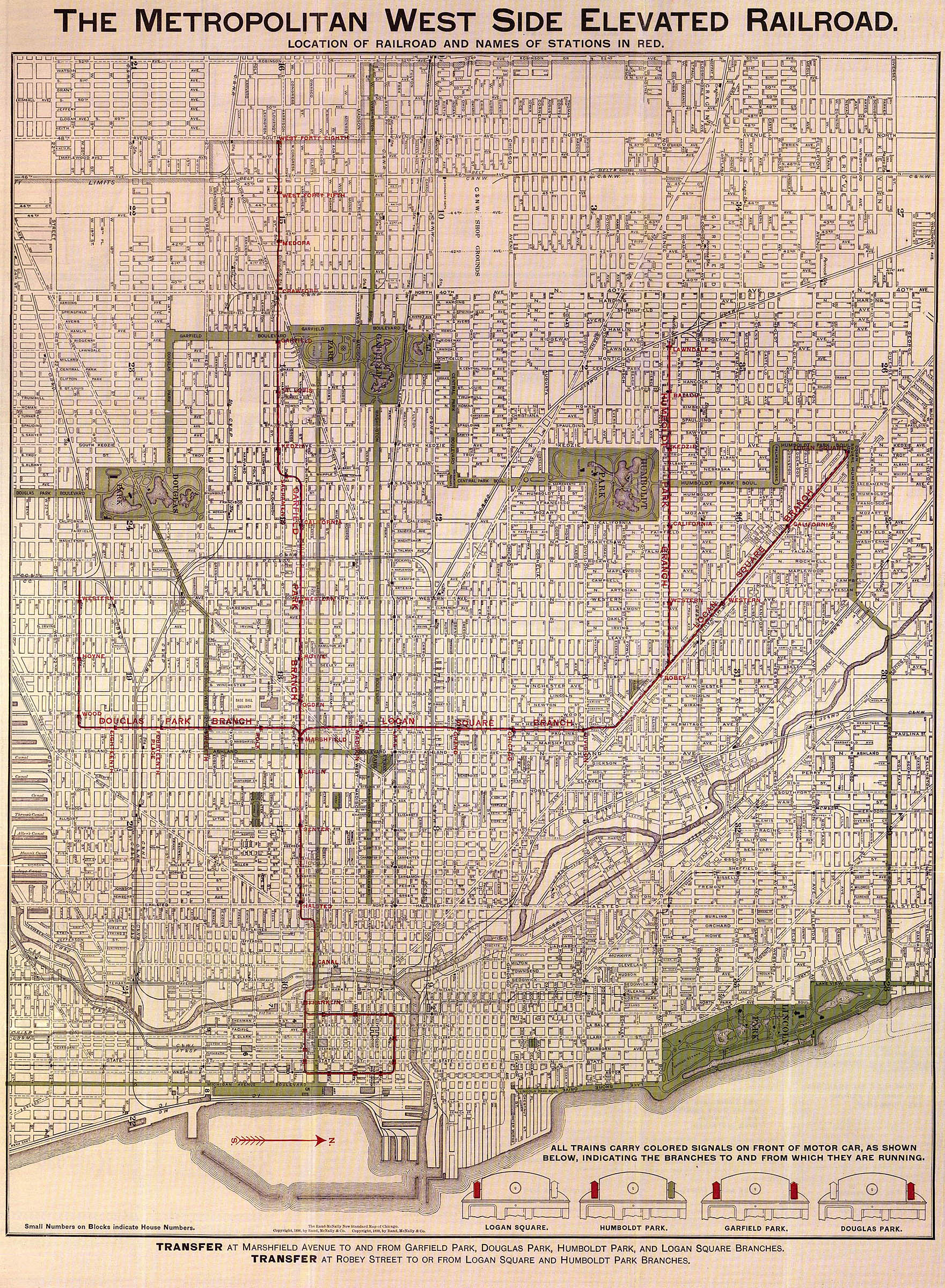
Aside: We have been doing a little research. Both the Douglas Line and the Paulina Connector were once part of a greater system built as the Metropolitan West Side Elevated. This system began (or ended) at a terminal on Franklin Street just east of the South Branch of the Chicago River and continued west on a four-track structure to the current alignment of the Paulina Connector/Douglas north-south leg. There, trains could proceed west on the Garfield Line (no longer there but rebuilt as the Congress [also Blue] Line). Trains could turn south on the Douglas, or they could turn north on the Connector and go to the Logan Square Line (also Blue today) which also had a branch to Humboldt Park.
Aside #2: Although using the "old" names for the lines seems to date us, can you see how just using the color names would be confusing?
Let's see what we've got with the two new sections of the Circle Line. By George! We've got a circle!
Starting at Medical Center on the Douglas, go north to Lake, east onto the Loop, southwest on the Midway, and north from Ashland/Archer back to the Douglas. This isn't the circle we want, but neither is the Circle Line as proposed. Remember, the premise was to connect and cross every transit route in the city.
Okay, first, and technically, you would have to build the circle further out from the Loop and probably somewhere closer to the current Chicago city limits. For the sake of argument, however, let's say that we have to at least start with the reasonable proposal set forth.
What's missing so far is a continuation of the south leg (Douglas Line at Woods Curve to Midway Line at Ashland/Archer) east to connect with the Dan Ryan (Red Line) and the Jackson Park/Englewood (also Green) Lines. We suppose that potential traffic would probably suggest an alignment somewhere near 35th Street to serve IIT and Sox Park. But our personal preference would be the historic alignment of the old Stock Yards and Kenwood branches along 40th Street and connecting with the Green Line at Indiana.
The latter alignment accomplishes something closer to the stated "connect and cross," but still misses most of the East Side routes. So why don't we just rebuild the old Kenwood Branch all the way to the lakefront? If we are not mistaken, the terminal there was a connection with the Illinois Central commuter line, and the lakefront is as far east as you can get (at 40th St.).
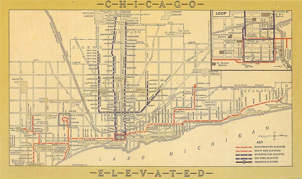
To assist my readers in understanding these routes, please check out this map on the Chicago Transit Authority Website. Also this map shows the Metropolitan West Side Elevated discussed above, and this map shows the routes of both the Stock Yards and Kenwood "L"s. On the latter map, you will see how close the proposed station at Ashland/Archer comes to the old "L" alignment in the Union Stock Yards. (This is now a bus loop.)
In Chicago's Circle IV, we will talk about What To Do About The North Side.
© 2006 - C. A. Turek - mistertrains@gmail.com
No comments:
Post a Comment